Is Trekking in Nepal Safe After the 2026 Flash Flood? Real-Time Route Status
Last updated: September 1, 2026. We review this page regularly and update it as conditions on the ground change. Road access in particular is shifting week to week right now, so always confirm route-specific details with a registered operator or the Nepal Tourism Board before you travel.
The short answer
Yes, the trekking regions of Nepal are safe after the 2026 flash flood, with one clear exception. But there's an important caveat this week: road access has become the real issue, not the trails themselves.
The August 26 disaster was severe but geographically contained, striking a single river corridor in the north-central part of the country. The one trekking region to avoid is Rasuwa district and the Langtang area, which sit directly in the flood's path. Every other trekking region such as Everest, Annapurna, Manaslu, Mustang, Kanchenjunga, and Makalu remained physically untouched. And major cities like Kathmandu, Pokhara, and Chitwan are operating normally.
What has worsened is the road network. Downstream flooding and erosion along the Trishuli have cut the Prithvi Highway at Krishna Bhir. This disrupted the main overland route between Kathmandu City and Pokhara. This doesn't affect the trails, but it does affect how you reach some of them. In this situation, flying appears as the smart choice. Details below.
Table of Contents
What happened in the Nepal flash flood 2026?
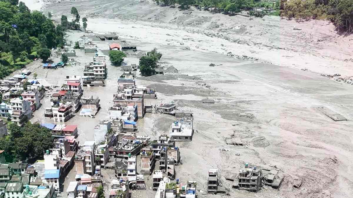
Aerial View of Flash Flood Nepal 2026 in Bhotekoshi River
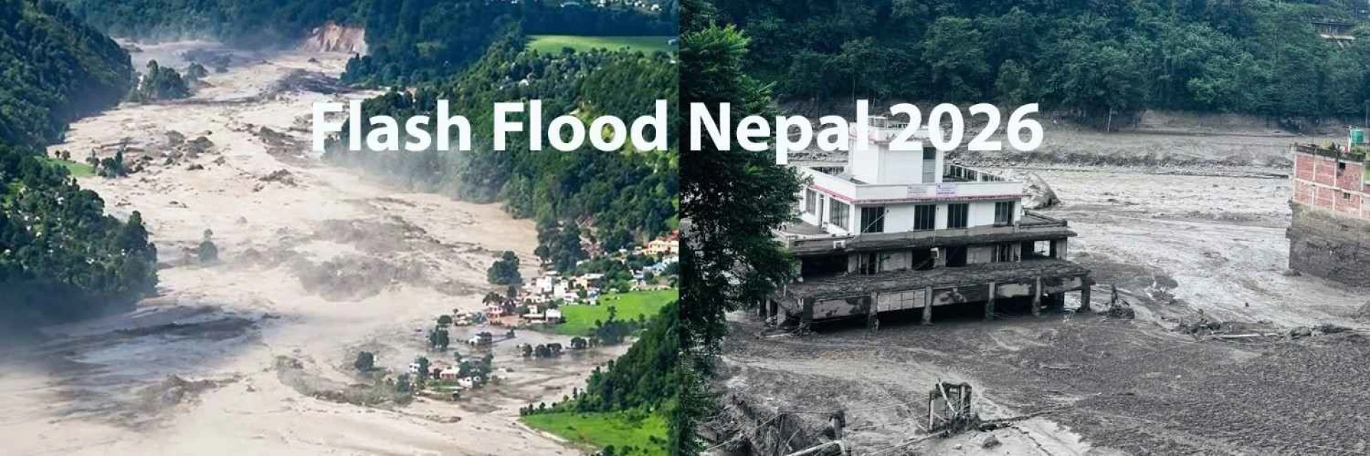
On the morning of August 26, a large mass of glacier ice and rock broke away high in the Himalaya near the Nepal–China border, in the mountains above the Langtang Lirung area. This was not a rainfall flood. According to Nepal's Hydrology Department, there was no unusual rainfall beforehand. It was a sudden collapse that sent a wall of ice, rock, mud and water down into the river system.
That water travelled down the Lhende Khola, into the Bhote Koshi, and then the Trishuli River, tearing through Rasuwa district and destroying roads, bridges, homes and hydropower infrastructure along the way. The event was large enough to be detected by seismometers around the world. The human toll has been heavy, and rescue and recovery work is ongoing. For current casualty figures, we point readers to official sources rather than repeating numbers that are still being confirmed.
The single most important fact for trekkers is this: the recent flood followed one drainage system, not the whole country. Nepal's major trekking regions sit in separate river basins that had no connection to it:
Everest / Khumbu drains into the Dudh Koshi
Manaslu drains into the Budhi Gandaki
Annapurna drains into the Marsyangdi and Kali Gandaki
None of those rivers feed into the Bhote Koshi or the Trishuli, so not a drop of the flood water or debris ever reached them. The trekking trails stayed physically intact for that simple reason. So when people ask whether it's safe, the honest answer is yes, provided you go region by region rather than lumping the whole country together.
Road update: Prithvi Highway is cut at Krishna Bhir
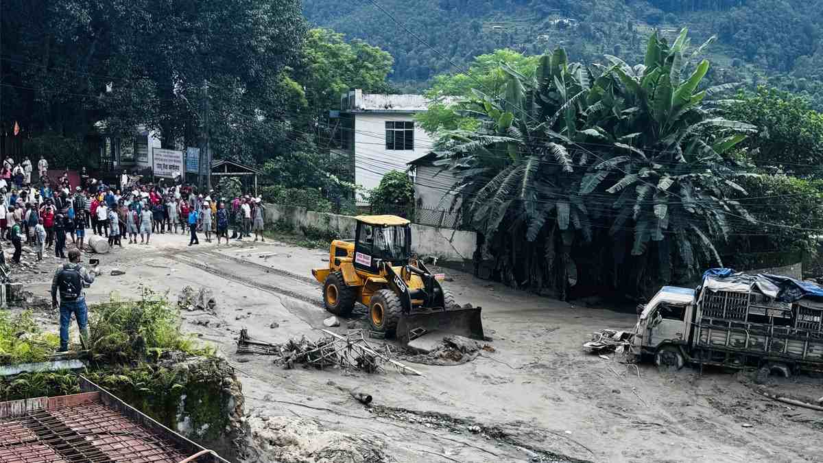
Mud being removed from affected area after devastating flood
If you're heading out soon, read this one first; it's changing fast.
The Prithvi Highway has caved in at Krishna Bhir (Benighat Rorang, Dhading). The Trishuli's running high right now, and it ate away the ground under the road. That's the main highway between Kathmandu and Pokhara, basically the way west, so this is a big deal. Officials are saying it could take about a month to fix.
There's a way around via Gorkha that's open to westbound vehicles, but be ready for it to add a good chunk of time to your trip. You may also take narrow rural passes, but the route may be blocked at any time due to landslide risk.
What this means for trekkers:
Fly Kathmandu–Pokhara instead of driving. The 25-minute flight is unaffected and completely sidesteps the highway closure. For any Annapurna-region trek right now, we'd strongly recommend flying.
The Manaslu approach is affected too, since it uses the same corridor. Access is currently working via detours (see below), but it's fluid.
The trails are not affected. This is purely about getting to the trailhead by road. Once you're in Pokhara or on the trail, nothing changes.
Hotels, restaurants and domestic flights running normally
Flood Affected: Langtang, Gosaikunda and the Tamang Heritage Trail
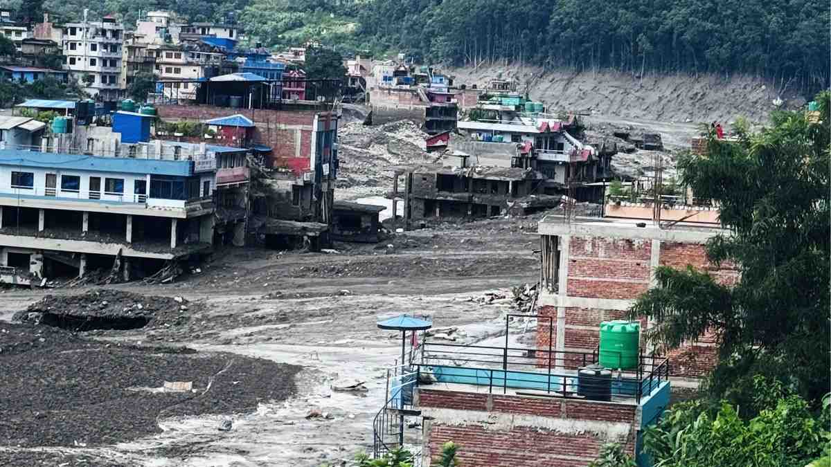
Devastation in local settlement after Flash Flood Nepal
All three treks begin from Syabrubesi, which sits right on the Bhote Koshi where the flood hit hardest. The gateway town suffered serious damage, and the access corridor was severed.
Early reports suggest the upper Langtang Valley trail itself — the climb toward Kyanjin Gompa — may not have been physically destroyed, because it follows a separate side valley. But that doesn't make the trek viable right now. The gateway is a disaster zone, local infrastructure is disrupted, and there are added risks from landslides, damaged bridges, and further monsoon rain. Authorities have also issued alerts about glacial-lake risk from the Tibetan side of the border. Treat these routes as on hold until a registered operator or the Nepal Tourism Board confirms safe, stable access.
The better news: an alternative road to Dhunche has reopened for light vehicles, and the region is expected to become feasible again — likely via a Dhunche/Thulo Syabru routing — from around late September, if road and trail safety inspections hold. If you have a Langtang trek booked, contact your operator now to discuss postponing, rerouting, or switching regions.
The middle case: Manaslu Circuit
The Manaslu Circuit deserves its own note because the honest answer is neither "fine" nor "closed."
The trail is unaffected — it sits in the Budhi Gandaki basin, well away from the flood. But the drive to the trailhead is disrupted because the standard approach uses the Prithvi Highway corridor now cut at Krishna Bhir. Not just that bridge has been damaged on the Malekhu–Dhading Besi section. Operators are reaching the trailhead via detours — for example, crossing the surviving Galchhi bridge over the Trishuli toward Dhading Besi, then the usual Arughat–Soti Khola–Machha Khola road, or via longer Gorkha-side routes.
Getting in is currently possible but genuinely fluid, with delays and day-to-day changes. If you have a Manaslu trek booked, confirm the current routing and timing with your operator and build in a real buffer. If your dates are flexible, later in the autumn will be far smoother.
Open trails — with a road caveat for the west
Everest Base Camp / Khumbu is the cleanest case: running exactly as before August 26. Lukla flights, permit desks, and teahouses are all normal, and access is unaffected by the situation on the Prithvi Highway.
Annapurna (Annapurna Base Camp, Circuit, Poon Hill) and Mustang have unaffected trails, but they're reached via Pokhara — and the Kathmandu–Pokhara highway is currently cut at Krishna Bhir. The fix is simple: fly Kathmandu–Pokhara (25 minutes, unaffected) rather than driving. Once you're in Pokhara, the drive to the trailheads and the trails themselves are normal.
Kanchenjunga and Makalu, in eastern Nepal, are entirely outside the affected corridor and reached from the east, so neither the flood nor the highway situation affects them.
Should you cancel your trek? A simple way to decide
Rather than one blanket decision about "Nepal," break it down by where you're going:
Everest, Kanchenjunga Trek or Makalu: No flood- or road-related reason to change anything. Proceed.
Annapurna or Mustang: Proceed, but fly to Pokhara rather than driving while the highway is out.
Manaslu: Proceed, but confirm the current access routing and timing with your operator, and allow buffer days.
Langtang, Gosaikunda or the Tamang Heritage Trail: Postpone or reroute. Wait for official confirmation of safe access, or switch regions with your operator's help.
Cancelling a trek in a region that wasn't hit won't make you any safer, and it does real damage to the guides, porters and communities who count on the autumn season, plenty of whom are the same people now helping with the relief effort. If your plans can bend at all, rerouting or shifting things around is the better call, for you and for them.
About the Kathmandu–Pokhara road
You may have seen the news that a stretch of the Prithvi Highway (the Kathmandu–Pokhara road) took some damage at Krishna Bhir, where the swollen Trishuli washed out part of the road. The short version: none of this affects your trek.
The trails are all fine. And in any case, most trekkers skip that road entirely and take the quick 25-minute flight from Kathmandu to Pokhara, which is running as usual. Whether you're headed for Annapurna Base Camp, the Circuit, Poon Hill or Mustang, just fly into Pokhara and carry on from there as planned.
For the road itself: government crews are actively working on it, alternative routes via Gorkha are already in operation for overland traffic, and repairs are underway. If you'd prefer to travel overland, just check the current status with us close to your date. But for most trekkers, the flight makes this a non-event.
How to check the real-time status before you go
Conditions can change quickly in monsoon. Before you set out, verify:
Trail conditions — route-specific, confirmed by your guide or a registered agency.
Road and flight access — how you'll actually reach the trailhead. For Pokhara-side treks, book the flight rather than the drive for now. A trail can be clear while the road to it is not.
Government advisories — your own country's foreign-ministry travel advice.
Nepal Tourism Board contacts: Toll-free 1234 · Hotline 1144 · Tourist Police +977 9851289445. If you or someone you know is stranded in an affected area, call these directly.
Frequently asked questions
Is it safe to trek in Nepal after the 2026 flash flood?
For most of the country, yes. The damage was limited to the Rasuwa/Trishuli corridor and didn't reach beyond it. The trekking routes around Everest, Annapurna, Manaslu, Mustang, Kanchenjunga and Makalu all came through fine. The one real hassle right now is road access between Kathmandu and Pokhara. The trails themselves are safe.
Is the Everest Base Camp trek affected by the flood 2026?
No. The Khumbu drains into the Dudh Koshi system, unconnected to the flood corridor, and it isn't affected by the Prithvi Highway closure either. Lukla flights and the EBC trail are normal.
Is the Annapurna Base Camp trek safe after the 2026 flood?
The ABC trail is unaffected. The catch is the road: the Kathmandu–Pokhara highway is currently cut at Krishna Bhir, so fly to Pokhara (25 minutes) rather than driving. From Pokhara, everything is normal.
Was the Kathmandu–Pokhara road affected by Nepal Flash Flood 2026?
Yes. The Prithvi Highway collapsed at Krishna Bhir after the Trishuli eroded it, and repairs may take up to a month. Fly Kathmandu–Pokhara as the workaround; overland detours via Gorkha exist but add considerable time.
Is the Manaslu Circuit open now?
The trail is open and unaffected, but the approach road is disrupted and being detoured. Confirm current routing and drive timing with your operator, and allow buffer days.
Which treks should I avoid right now?
Langtang Valley, Gosaikunda and the Tamang Heritage Trek, all accessed through the flood-hit Syabrubesi gateway, plus the Kailash Mansarovar route via Rasuwagadhi.
Can I still fly into Pokhara and Lukla?
Yes. Domestic flights are running normally and are the recommended way to reach Pokhara while the highway is out.
Should I cancel my booked trek?
Only if it runs through the affected Langtang/Rasuwa corridor. For other regions, adjusting — flying instead of driving, or rerouting — beats cancelling. Talk to the operator.
Kishwor Adhikari is a passionate writer with a deep enthusiasm for trekking and adventure. His extensive travels across Nepal, exploring its diverse landscapes and hidden corners, have shaped his unique perspective on the country's natural beauty. With a wealth of first-hand experience in adventure trekking, Kishwor has become a trusted voice for fellow enthusiasts. Through his writing, he shares invaluable insights, offering practical advice and inspiration for both seasoned trekkers and novices alike. His dedication to sharing his journey and knowledge helps others discover the wonders of Nepal's wilderness, making his work an essential resource for anyone seeking adventure in the region.