Tilicho Lake is the highest glacial lake in the world. It sits in Nepal’s Manang District within the Annapurna Conservation Area. I got to this lake at half past nine in the morning, out of breath, half-frozen, and honestly a little annoyed at how long the final climb was taking. Then I came over the last ridge and just stopped talking. This literally happens in this place; everyone goes quiet at the same spot.
That's Tilicho Lake in a nutshell. Nobody prepares you for the color of the water against all that grey scree and white peaks. Photos flatten it. You need to stand there to feel what this lake actually is.
This is a practical guide from Breeze Adventure, not a brochure. I'll walk you through the route, the real altitude numbers (there's some disagreement, more on that below), what it costs, when to go, and the parts of the trek that deserve more respect than most blogs give them.
Table of Contents
Where Tilicho Lake Actually Is
Tilicho Lake Nepal sits in the Manang district, tucked inside the Annapurna Conservation Area in north-central Nepal. It's west of Manang village, sitting right below Tilicho Peak (7,134 m), with Annapurna II, Gangapurna, and the Nilgiri range crowding the skyline around it.
It isn't on the main Annapurna Circuit trail. You have to branch off toward it, which is exactly why it stays quieter than Everest Base Camp or the main circuit route. Fewer people make the detour. That's their loss and your gain.
Locally, and in Hindu tradition, the lake is tied to the Ramayana. Some believe it's the Kak Bhusundi Lake mentioned in the epic, where the sage took the form of a crow. Buddhist pilgrims hold it sacred, too. You'll notice prayer flags near the shore, left by people who came for reasons that had nothing to do with trekking photos.
Stunning picture of Tilicho Lake Nepal
Tilicho Lake Altitude: The Numbers, Sorted Out
Here's where guidebooks disagree. Most current sources, including the Nepali government's hydrology department, put the Tilicho Lake altitude at 4,919 meters (16,138 feet). You'll also see 4,949 m and even 4,920 m floating around in older trekking company brochures. The difference comes down to which survey and which era of mapping got used, and honestly, it's not something worth losing sleep over. What matters practically is this: you're trekking to almost 5,000 meters, and the air up there has roughly half the oxygen you're used to breathing at sea level.
For comparison, Everest Base Camp sits at 5,364 m, and Thorong La Pass, which a lot of trekkers cross right after visiting the lake, hits 5,416 m. So Tilicho Lake height isn't the highest point of a combined Annapurna Circuit trip. But it's the highest lake most people will ever stand beside. That claim of being the "world's highest lake" gets repeated constantly, and while there's some debate among geographers about lakes at even higher elevations elsewhere in the Himalaya, Tilicho remains the highest one that's genuinely accessible on foot without technical climbing gear.
The lake itself stretches close to 4 kilometers long and just over a kilometer wide. No fish live in it. The water's too cold, and the lake has no real outlet, so nothing's ever colonized it. It just sits there, glacier-fed, impossibly still on windless mornings.
Board in Tilicho Base Camp area suggesting time for Tilicho Lake
Tilicho Lake Route and Tilicho Lake Base Camp
Most people start this trek from Besisahar or drive further to Chame, then walk the classic Annapurna Circuit trail through Pisang and into Manang (3,540 m). Manang is where your body needs to slow down. More on that in the acclimatization section below.
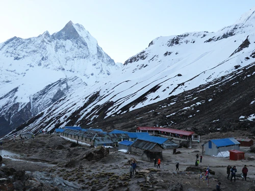
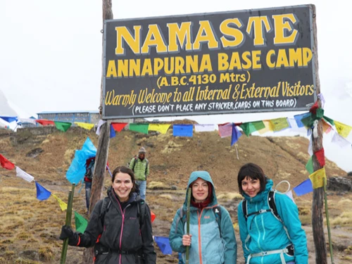
From Manang, the trail leaves the main circuit route and heads toward Khangsar, the last proper village before things get remote. After Khangsar, you cross a long stretch of exposed scree and landslide terrain before reaching Tilicho Lake Base Camp, sitting around 4,140 m. This is where you sleep the night before your lake day, a scattering of basic teahouses with thin walls and thick blankets. This is exactly the trade you want at that altitude.
From base camp, it's roughly 800 vertical meters of climbing over loose scree to reach the lake itself. Most guides push you out the door by 5 or 6 am, both to catch calmer weather and to give yourself enough daylight to get back down safely. The climb takes three to four hours, depending on your pace and the snow conditions that season.
One stretch deserves a paragraph of its own: the section between Khangsar and base camp crosses an active landslide zone. It's narrow, the ground shifts underfoot, and rockfall does happen. You also lose phone signal here. Walk it early in the day, don't linger for photos, and keep your eyes on the slope above you, not just your feet.
Best Time to Go: Tilicho Lake Weather and Temperature
Autumn (late September through November) is the classic window. Skies are clear, trails are dry, and the mountain views are about as good as the Himalaya gets. It's also the busiest stretch, so expect company at the teahouses.
Spring (March to May) runs a close second. Rhododendrons bloom lower down the valley, the weather holds reasonably steady, and there are fewer trekkers on the trail above Manang. I've done it in both seasons and honestly prefer spring for the quiet, even if the lake itself can still be partly frozen depending on how late into the season you go.
Winter is possible but requires good preparation. Heavy snow can close the route entirely, and Tilicho Lake temperature at that altitude regularly drops well below freezing overnight, even inside the tea houses.
Monsoon season (June to early September) brings landslide risk on that already dicey scree section. Also, the clouds may hide the exact views you came for. But this is best for a peaceful trail.
As a rough guide for daytime highs at the lake itself, you can expect single digits Celsius even in the warmer months. However, dropping to well below zero once the sun goes down. Nights at base camp regularly hit -10°C to -15°C in autumn and spring, colder in winter. Bring a sleeping bag rated for those numbers, not the "comfortable at home" kind.
Snowy trail towards Tilicho Lake
How Much Does the Tilicho Lake Trek Cost
This varies a lot depending on how you travel, but here's a realistic breakdown for 2026.
Permits: You'll need two: the Annapurna Conservation Area Permit (ACAP), running around NPR 3,000 (roughly $22–30), and the TIMS card, around NPR 2,000 (roughly $15–20). Both are sorted in Kathmandu or Pokhara before you start, and a guiding agency will usually handle this paperwork for you if you're going that route.
Guides and porters: A licensed guide is mandatory for this trek, as this falls within the Annapurna Conservation Area. A guide typically runs $25–40 a day, a porter around $20–30. Two trekkers can often split one porter.
Teahouses and food: Expect $5–15 a night for a room, climbing as you get higher, and supplies get harder to bring in. Meals run $7–12 each at altitude. Budget roughly $30–50 a day total for food and lodging once you're above Manang.
Total trip cost: For a guided package covering 10 to 16 days (depending on whether you cross Thorong La Pass afterward), figure somewhere between $900 and $2,000 per person, all-inclusive.
Extras worth planning for: hot showers ($1–3), Wi-Fi ($1–3 a session), and bottled water, which gets pricier the higher you climb. Bring a filter or purification tablets and save yourself the money and the plastic.
Tilicho Lake Difficulty Level
The Tilicho Lake trek doesn't demand technical climbing skills. It can be compared with the Annapurna Circuit trek difficulty, as both represent sam eregion trekking. No ropes, no ice axe, nothing like that. What it demands is stamina and patience with altitude. Walking days run five to eight hours, often over uneven, rocky ground. And the elevation gain from the lower valleys to nearly 5,000 meters happens faster than your body would naturally like.
Altitude sickness is the real risk here, not the terrain. Rushing is what gets people into trouble. Build in a proper acclimatization day at Manang, most itineraries include a side hike to Ice Lake or Gangapurna Lake specifically so your body adjusts before pushing higher. Watch for headaches, nausea, and unusual fatigue, and don't be a hero about it. If symptoms worsen, descend. That's not negotiable at this altitude.
I'd call this a moderate-to-challenging trek. Fit beginners manage it fine with the right pacing. People who've done at least one multi-day trek before will find the altitude more familiar, but past experience matters less than a slow, sensible ascent plan.
There's a marked viewpoint spot near the northeastern edge of the lake where most people stop. It's worth knowing what you're looking at before you get there so you're not just staring blankly (which, fine, I also did).
You're looking across turquoise-to-navy water toward what locals call the Great Barrier. This is a wall of glaciated peaks that seems to rise straight out of the lake itself. Tilicho Peak sits behind you to the south. On a clear morning, the water shifts color as the sun moves, from deep steel blue to something closer to emerald near the shallows. There's no vegetation up here, just rock, ice, and water. It feels less like Nepal and more like another planet, which a lot of trekkers say.
Don't expect to linger for hours. Wind picks up fast once the morning sun starts warming the surrounding slopes, and most guides want you heading back down by mid-morning. Get your photos, sit with them for a bit, and start the descent while conditions are still good.
Combining Tilicho Lake With Thorong La Pass
A lot of trekkers add Tilicho Lake as a side trip on the classic Annapurna Circuit, then continue on to cross Thorong La Pass (5,416m) toward Muktinath. It's a natural pairing, and one of the more rewarding combinations in Himalayan trekking.
You get the lake's stillness and then the pass's sheer scale within the same week. Just know it adds several days and a serious amount of extra altitude gain, so factor that into your fitness planning and your timeline.
Quick Packing Notes
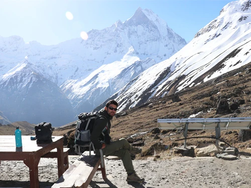
Layers matter more than any single expensive item. A good down jacket, a sleeping bag rated to at least -15°C, sturdy broken-in boots, trekking poles for the scree sections, and sun protection.
The UV at this altitude is no joke, even on cold days. Diamox (acetazolamide) is worth discussing with a doctor before you go, as a preventive measure against altitude sickness, not a cure for ignoring it.
Tilicho Lake FAQ
What is the Tilicho Lake altitude?
Around 4,919 meters (16,138 feet), though some older sources list 4,949 m.
How many days does the Tilicho Lake trek take?
Most itineraries run 10 to 16 days from Kathmandu, depending on your starting point and whether you continue over Thorong La Pass.
Do I need a guide?
Yes, a licensed guide is mandatory. This is a landslide-prone section near base camp, and the weather changes up there. The guide will help you navigate the way and deal with such situations.
What's the best month to visit Tilicho Lake?
October and November for the clearest skies, or April and May if you'd rather trade a bit of weather stability for smaller crowds.
Can beginners do this trek?
Fit beginners with no prior high-altitude experience can manage it, provided they build in proper acclimatization days and don't rush the ascent.
Tilicho Lake isn't a trek you do halfway. It asks for patience on the approach and rewards you with something that genuinely doesn't look real once you're standing there. Go with the right season, the right pacing, and a guide who knows that scree slope better than you ever will. It'll be one of those places you keep thinking about long after you're back at sea level.
Kishwor Adhikari is a passionate writer with a deep enthusiasm for trekking and adventure. His extensive travels across Nepal, exploring its diverse landscapes and hidden corners, have shaped his unique perspective on the country's natural beauty. With a wealth of first-hand experience in adventure trekking, Kishwor has become a trusted voice for fellow enthusiasts. Through his writing, he shares invaluable insights, offering practical advice and inspiration for both seasoned trekkers and novices alike. His dedication to sharing his journey and knowledge helps others discover the wonders of Nepal's wilderness, making his work an essential resource for anyone seeking adventure in the region.