13 Days Manaslu Circuit Trek

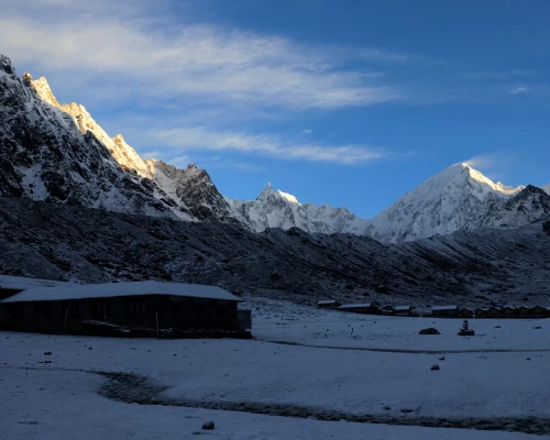
Mt. Manaslu in the morning, 8th highest mountain in the world
At a Glance
  • Duration16 Days
  • Difficulty Level Moderate
  • Max Altitude 5120m
  • Group Size 1 -15 Person
  • Start City Kathmandu City
  • End City Kathmandu City
  • Trip Type Private and Group Joining
  • Activity Trekking and Hiking
  • Best Season March - June and September - December
Trip Highlights
  • Remarkable hospitality and ethnic Tibetan Buddhist culture
  • Larke La Pass (5135m) leaves you surrounded by a fortress of snowy peaks
  • A trail that is vastly underrated and unpopulated, providing a more peaceful journey
  • A variety of landscapes – from subtropical jungle to the rugged high alpine environment
  • Traversing the many thrilling suspension bridges over the BudhiGandaki river gorge

Manaslu Circuit Trek, located in the northwest area of the country, is a world-class journey into the Himalayas. Some consider it the best all-around trek in Nepal, and it is a great alternative to the Annapurna Circuit Trek.  It is truly one of the most adventurous treks in Nepal and the fact that it is not heavily populated by other trekkers is a huge bonus.  The path joins two different regions: the Manaslu region with the Annapurna region. It follows a strenuous trail that circumnavigates the magnificent Manaslu(8156m) – the 8th tallest mountain in the world. Manaslu and the surrounding jaw-dropping peaks all around us soar high above the clouds.

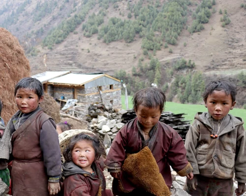
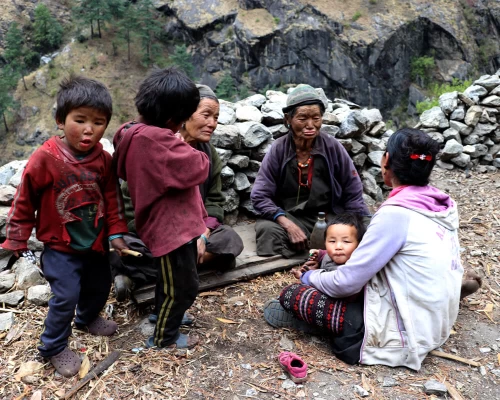
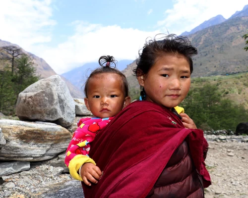
At the beginning of the trek, we pass through ethnically Gurung villages.  Reaching higher altitudes, the population is almost completely Tibetan, and a different dialect is spoken.  Throughout the Manaslu Circuit Trek, we are offered brilliant hospitality. They are kind and open-hearted. Much of the allure that comes with trekking in the Himalayas goes beyond the high alpine landscapes and snow-capped peaks.  The warmth of the villagers is unlike anywhere else in the world. 

The trail begins from SotiKhola (700m), along with the banks of the turquoise Budi Gandaki River.  The area is home to rice fields, waterfalls, and fresh air.  You are sure to find water buffalo roaming around and keep a lookout for the dozens of other mammal species including the musk deer, and in the higher elevation, you may catch a glimpse of the evasive snow leopard.

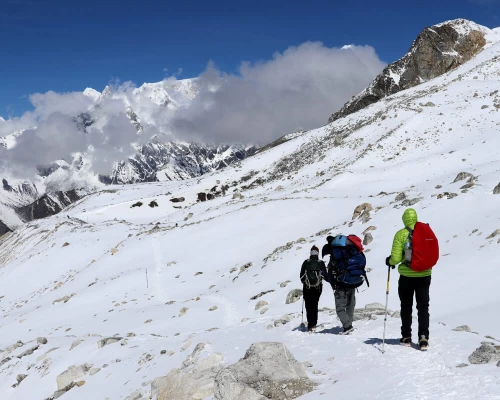
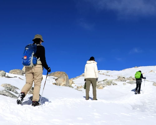
From here, we climb continually north and toward higher altitudes. High in these mountains, we may share the path with yak caravans.  A major highlight of the trip is the Larkya La Pass(5135m) and Manaslu Base Camp where trekkers are exposed to awe-inspiring Himalayan views.  The pass is usually covered in snow, which makes it a bit more of an adventure.  We are eye-to-eye with these massive peaks, which make us feel humbled to be in their presence. The majestic views of the high Himalayas, dense forests, deep gorges, and scattered mixed and ethnic settlements is not to be missed.  Two days after the pass, we arrive in Dharapani, take a two-hour drive to Besisahar, and stay for the night.  The following day we say our tearful goodbyes to the mountain and return to Kathmandu.

Best Time for Manaslu Circuit Trek

The best time for the Manaslu Circuit is autumn (second half of September, October, and November) and spring (March, April, and May). September provides post-monsoon blue skies, warm weather, lush greenery, and clear Himalayan views.  October and November are the most popular months for this trail, as the mountain views are best and the weather is reliably pleasant.

Spring is an equally favorable season for the Manaslu Circuit Trek. After winter, alpine flowers begin to bloom, creating vibrancy in the high meadows. Open skies allow for amazing views of snow-capped peaks. In March, rhododendrons (Nepal’s national flower) begin to bloom. April and May are also popular because of the clear skies and warm weather. Although the Manaslu Circuit Trek can be taken anytime throughout the year, spring and autumn are considered the best seasons because of the mountain views and great weather.

The Difficulty of Manaslu Circuit Trek

The Manaslu Circuit (with Manaslu Base Camp and Larke La Pass) is a moderate-grade trek. Starting at an altitude of 930 meters in Soktikhola, the trail leads all the way up to 5135 meters at the Larke La Pass. The trail is remote, rocky, and steep in some sections. The most difficult parts of the trek are the altitude and the rugged inclines/declines on the trail. 

The total length of the Manaslu Circuit is 177 kilometers (110 miles). Expect to walk about 15-20 km per day for about 10-12 days. The first few days are spent on a steep, narrow trail that follows the Budhi Gandaki gorge. Then, from Lho village, the trail is smoother and not as steep, but the altitude gives trekkers a challenge. The altitude gets especially challenging on the hike to Manaslu Base Camp and crossing the Larke La Pass, but if you are well-hydrated, you shouldn’t have any issues. Taking in the spectacular beauty and experiencing the kindness of the locals will make you forget about all the difficulties.

Trekking Trail on Manaslu Circuit Trek

The first section, to Tatopani, is on a newly built road that does not allow vehicles. Then, the real mountain trail begins. It’s a bit rocky until Namrung, where the trail is nice and well-maintained to Samdo. The trail to Manaslu Base Camp is pleasant for about an hour and then it gets narrow and rocky you plan on going to Pungyen Gompa, the trail is flat for a while and then uphill and rocky to the Gompa. From Samdo to Dharamsala is steep up and then steep down to Bhimtang. This trek is getting more and more popular each year, so it continues to be upgraded. Overall, it is safe and well-maintained. 

Permits for Manaslu Circuit Trek

Manaslu Circuit Trek is considered a restricted area, in order to regulate tourism in the area. Solo trekkers are not allowed to enter the area without proper permits. To get the restricted area permit, there must be a minimum of two people in your group and you must be accompanied by a government-licensed trekking guide. If you do not have two people, you can bypass this by paying the permit price for a second person and going alone with your guide. This trek requires 3 different permits (4 if you would like to explore the Tsum Valley as well). The permit costs depend on the number of days and in which month you are trekking.

Manaslu Restricted Area Permit (RAP)

September – November: $100 per person for a week and an additional $15 per person per day from the 8th day and onwards. 

December – August: $75 per person for the first week and $10 per person per day from the 8th day and onwards. 

Manaslu Conservation Area Permit (MCAP)

The cost of the MCAP is $8 for SAARC nationals and $30 for all other foreigners. 

Annapurna Conservation Area Permit (ACAP)

After crossing the Larke La Pass, you enter the Annapurna Conservation Area, where it is necessary to have the ACAP permit upon reaching the Dharapani checkpoint. The cost for ACAP is $8 for SAARC nationals and $30 for all other foreigners.

Why take the Manaslu Circuit Trek?

First of all, the view of Manaslu (the 8th highest peak in the world) is unprecedented. You get to explore the pristine landscape that makes up the lap of Mount Manaslu. Hike through fields of rare wildflowers, next to alpine lakes and glaciers, through dense forests, and desolate mountain landscapes. The culture is equally fascinating. Though they have little, they are happy with what they have. There are many lessons to be learned in the Himalayas, and one is to enjoy the simple beauty in life. The precious mix of culture, and nature, cannot be found anywhere else in the world.

Itinerary

Expand all Collapse all

Welcome to Nepal! A representative from Breeze Adventure will welcome you our hotel.  We will prepare you with information and gear for your trek. Overnight at hotel.

  • Max Altitude: 1400m
  • Accommodation: 2/3 Star Hotel
  • Meals: Breakfast
  • Transport: Car,Van

Have breakfast and start sightseeing around Kathmandu in a private vehicle.  We will see several UNESCO World Heritage Sites.  We will learn about each site’s historical, religious, and cultural significance.  Overnight at hotel.

  • Max Altitude: 1400m
  • Accommodation: 2/3 Star Hotel
  • Meals: Breakfast

We set off early today to Machhakhola. During the drive, we have views of the countryside, with glimpses into the locals’ lifestyle and surrounding mountain sceneries. We drive on a smooth road from Kathmandu to DhadingBesi, the district headquarters of Dhading (1050m) but the drive from DhadingBesi to Arughat will be on a rough road.  Upon reaching Arughat, a major town in the region, we drive further towards MachhaKhola. Overnight in a guest house.

  • Max Altitude: 590m
  • Accommodation: Teahouse
  • Time: 8/9 Hours
  • Meals: BLD
  • Transport: Jeep

Our narrow trail makes a few small ups and downs and eventually traverses over the TharoKhola to reach Khorlabesi. After a few more ups and downs, we come across a small natural hot spring in Tatopani. From the hot spring, we move over another ridge and cross the Budhi Gandaki on a suspension bridge. At this juncture, we climb on a wide, well-crafted staircase, then across a landslide and over a ridge to Doban. After we cross the suspension bridge over the YaruKhola, we climb the stone stairs and descend to the river. We again climb more stone stairs to TharoBharyang. Crossing the west bank of the Budhi Gandaki, we climb over another ridge and walk along the river to eventually reach the village of Jagat. Overnight in a guest house.

  • Max Altitude: 1370m
  • Accommodation: Teahouse
  • Time: 6 Hours
  • Meals: BLD
  • Walking Distance: 16km

After breakfast, our day begins by climbing over a rocky ridge to Salleri and then descending to Sirdibas. The valley widens as the trail continues up to GhattaKhola. We continue walking upstream to a long suspension bridge in Philim, a large Gurung village. The trail stays fairly level as it crosses millet fields to Ekle Bhatti. The route now enters a steep, uninhabited gorge. At this point, we descend to the grassy slopes, cross the Budhi Gandaki, and then trek along the west bank for a while. As we continue through the trail, the valley widens and we pass through bamboo forests to the Deng Khola. Soon after, we will reach the tiny village of Deng. Overnight in a guest house.

  • Max Altitude: 1920m
  • Accommodation: Teahouse
  • Time: 7 Hours
  • Meals: BLD
  • Walking Distance: 19km

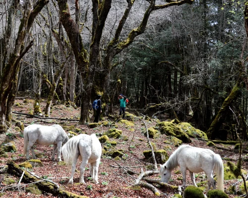
After leaving Deng, we cross the BudhiGandaki again and ascend to Rana (1910m). We go up a bit more to take the trail from Bhi, then head west up the Budhi Gandaki valley. The trail passes through mixed forests. We take the route that goes through the village, which has a perfect viewpoint for SiringiHimal. We cross the Budi Gandaki several times today and come across several gompas as well, which we can stop for a visit. The trail follows the river upstream through a dense forest. The forest becomes less dense and the trail is level again. The pleasant walk continues and after the last steep incline, we reach Namrung. Overnight in a guest house.

  • Max Altitude: 2250m
  • Accommodation: Teahouse
  • Time: 7 Hours
  • Meals: BLD
  • Walking Distance: 18km

Right when you leave your bed, you have awesome views of Siring and Ganesh Himal, and from the village, you can also see Hiunchulito from the south. We climb steadily, passing through forests to reach Lihi, a fine village with many Chhortens and barley field terraces. The trail drops and crosses the side valley of Simnang Himal with Ganesh Himalin eyeshot. We pass through the Sho, Lho, and Shyala villages before reaching Sama. We enjoy extraordinary views of Manaslu from Lho, where we can also explore the famous Ribung Gompa. In Shyala, we find ourselves encompassed by high peaks like Hiunchuli and Peak 29 (NgadiChuli) to the left, with Manaslu and large glaciers straight ahead, and at the far end stands Ganesh Himal. Today’s journey ends in Samagaon. Overnight in the guest house.

  • Max Altitude: 3450m
  • Accommodation: Teahouse
  • Time: 7 Hours
  • Meals: BLD
  • Walking Distance: 17km

Today, we take it easy and let our bodies become accustomed to the altitude.  If you have any interest, we can do a day hike and explore the surrounding area.  There is two option for our acclimatization day. The first one is the hike up to Manaslu Base Camp via Birendra Lake and the second one is Pung Gyen Gumpa. The first option to the Manaslu Base Camp via Birendra Lake takes about 5-6 hours and offers an awesome view of the Himalayas and Samagaun village. The second takes about 4-5 hours to the very old Monastery offers a beautiful view of Mt. Buddha and other mountains. Overnight again in the guest house.

  • Max Altitude: 5100m/ 4400m
  • Accommodation: Teahouse
  • Time: 5 Hours
  • Meals: BLD
  • Walking Distance: 9km

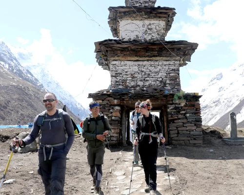
Today, we descend to the BudhiGandaki River, which has turned north, and follow it to a bridge over a side stream. The trail to the left leads to Manaslu Base Camp. The Larke La Trail passes several mani walls as the valley widens. It is an easy trail above the river passing juniper and birch forests of KermoKharka. We drop down, cross the Budhi Gandaki on a wooden bridge, and climb steeply. From a stone arch, we can view a large white kani. Finally passing through the kani, we find Samdo. Overnight in a guest house.

  • Max Altitude: 3780m
  • Accommodation: Teahouse
  • Time: 4 Hours
  • Meals: BLD
  • Walking Distance: 10km

Soon after heading out on the trail, we cross the wooden bridge over the Budi Gandaki and walk on and upward. After crossing two streams and witnessing the Larkya Glacier we go around the valley of the SalkaKhola and climb up again to the stone guest house (4460m), which is not a lodge but rather a shelter called Dharmshala, also known as LarkePhedi. The short walk today also leaves plenty of time for acclimatization and hanging out in the afternoon. Overnight in a guest house.

  • Max Altitude: 4460m
  • Accommodation: Teahouse
  • Time: 5 Hours
  • Meals: BLD
  • Walking Distance: 8km

After a short climb, we reach a valley on the north side of the Larkya Glaciers from where we can enjoy great views of Cho Danda and Larke Peak. Finally, we walk across the moraines of the glacier, making a gradual ascent that becomes steeper in the last section of the pass. In the pass, there are outstanding views of HimlungHimal, CheoHimal, Kangguru, and the massive Annapurna II. It is a longer day than usual to Bimtang, but to walk into these low pastures with the evening mist coming in and face-to-face views of Manaslu is an exciting experience. Overnight in a guest house.

  • Max Altitude: 5135m
  • Accommodation: Teahouse
  • Time: 7 Hours
  • Meals: BLD
  • Walking Distance: 19km

Surki is our stopover for lunch today. We therefore head off in this direction. On narrow paths mostly, we reach Surki, a small settlement, in about four hours. This is where we stop for lunch in one of those five or six service providers. It takes a couple of more hours for us to reach Tilje from here on. Although Tilje is a small settlement, it provides us with many places to options for our accommodation. Overnight in a guest house.

  • Max Altitude: 2240m
  • Accommodation: Teahouse
  • Time: 6 Hours
  • Meals: BLD
  • Walking Distance: 16km

Today, we start out on a long, but easy descent. We stopped at Dharapani on the way for lunch. Lunch is over and we continue. Crossing into the Annapurna Conservation Area requires us to produce one more permit. Soon, we make it to Besisahar after a scenic drive of about 3 hours. Overnight in a guest house.

  • Max Altitude: 760m
  • Accommodation: Teahouse
  • Time: 2 Hours
  • Walking Distance: 5km
  • Transport: Jeep

Our return to Kathmandu is on a tourist bus, a ride that should last for around six hours. With breakfast and lunch on the highway, the bus stops in Kathmandu. We’ll have a farewell dinner in the evening for you. Overnight in a hotel.

  • Max Altitude: 1400m
  • Accommodation: 2/3 Star Hotel
  • Meals: BLD
  • Transport: Bus

Transfer to Tribhuvan Airport.  Thank you for choosing Breeze Adventure as your trekking guide!  We look forward to your next adventure with us.

  • Meals: Breakfast

Our team has designed the Manaslu Circuit Trek itinerary with our years of experience in the field. It follows the same route that most trekkers take. The given itinerary is for those who have limited time in Nepal. If you have more time and would like to check out some of the day trips available, we can design the perfect itinerary tailored to your interests. Just let us know your holiday dates and we will handle the rest!

Cost Details
What's Included
  • Transportation to and from Tribhuvan Airport.
  • Three nights in a 2-3 star hotel in Kathmandu, breakfast included.
  • All transportation for the trek.
  • Local guest house accommodation in mountain.
  • Government-authorized, experienced guide and porters
  • Insurance, food, accommodation, and wage for guides and porters
  • Hygienic meals (breakfast, lunch, and dinner) during the trek.
  • All equipment (sleeping bag, warm layers, etc.)
  • TIMS Card and all additional permits
  • First Aid Kit
  • Maps
  • Service charge and government taxes
  • Post-trek celebration dinner in Kathmandu
What's Not Included
  • International airfare
  • Meals in Kathmandu (besides breakfast)
  • Your personal expenses, shopping, etc.
  • Shower and electronic charging fees at guest houses during the trek
  • Alcoholic drinks, chocolates, tea and coffee
  • Tips for guide and porter
  • Extra accommodation and meals outside of itinerary
  • Costs from unexpected occurrences (i.e. cancellations, weather problems, damages of property, illness, etc.)
Group Discount Prices
Number of peoplePrice per person
2 pax
US$1300
3 - 5 pax
US$1250
6 - 10 pax
US$1199
11 - 15 pax
US$1099

Essential Information

Accommodation on Manaslu Circuit Trek

Accommodation in the Manaslu region is improving year after year. Rooms are typically on a sharing basis, equipped with a bed, blanket, and pillow. There is a shared bathroom nearby the room. Rooms are neat and clean, with amazing views right from your window. In the lower villages, rooms are basic, but in Samagon, Samdo, and Lho, rooms are a bit nicer. Your accommodation is included in the price of the package.

Food and Drinks on Manaslu Circuit Trek

Manaslu Circuit is a teahouse trek, so all your meals will be had in teahouses. The three meals are prepared fresh and are hygienic. All 3 meals a day are included in the cost of the package. The menu at each guesthouse will be slightly different, but at each one, there will be options for Indian, continental, Italian, and local Nepali food. Of course each day you will have the option of dal bhat, the typical meal in Nepal. It consists of dal (lentil soup), bhat (rice), Tarkari (vegetable curry), and usually some spinach and other add-ons. Let us know if you have any dietary restrictions or other questions.

All kinds of drinks are available on the Manaslu Circuit Trek. Tea is popular, especially in the higher/colder areas. Having a hot cup of tea with mountain views to end your day is a special thing. Beer/alcohol is available, but not recommended in the high altitude regions, as it can contribute to altitude sickness.

Acclimatization Day

Acclimatization days are essential on the Manaslu Circuit Trek. Acclimatization helps adjust to the different levels of oxygen in the air at a high altitude. There is an acclimatization day in Samagaon, from where we hike to Manaslu Base Camp or Pungyen Gompa – whichever you prefer. Hiking high and sleeping low is the name of the game when it comes to acclimatization. So, on this day we increase our elevation and head back to Samagaon.

Geography of Manaslu Circuit Trek

Manaslu Circuit lies in the Manaslu Conservation Area. The trail starts in the sub-tropical Himalayan foothills and stretches into the arid trans-Himalayan pastures on the border of Tibet. Starting from Arughat and leading up to the Larke La Pass, the trail crosses 6 different climate zones: tropical, sub-tropical, temperate, sub-alpine, alpine, and arctic. Few trails in the world lead you through such diverse landscapes.

Communication/WiFi on Manaslu Circuit Trek

The Manaslu Circuit lies in a remote area of the Himalayas, so you may not have cell phone service or WiFi at all times. Nepal Telecom offers a SIM card that allows you to be connected throughout most of the trial and offers data as well. Also, there is WiFi in some of the guesthouses (for an additional cost), but it is not always guaranteed. It’s always nice to stay connected with your friends and family, but if you have to disconnect for a while, don’t worry! The mountains will give you company.

Charging Electronics

There are a few micro hydro charging stations along the trail that you can use. Each guest house also has a charging station, which usually requires you to pay 200+ rupees for a full charge. We recommend bringing a solar panel, as it’s a free and convenient way to charge your electronics.

Guide and Porters

Manaslu Circuit Trek requires a government-licensed guide, as it is in a restricted area. Our experienced guides and friendly porters will lead you on the trail, introducing you to the Himalayas and the quaint, charming villages along the way. The porters also carry your belongings and ensure that you have a comfortable trip. If the group is large, there will be 2 or more guides.

Transportation

Manaslu region is located between the Annapurna and Langtang regions, northwest of Kathmandu. The starting point of the trek is Soti Khola, 138 kilometers from Kathmandu. You will arrive at and depart from the area by car. All transportation is included in the given cost of the package.

Safety on Manaslu Circuit Trek

This is a safe trek, although there are a few things to be aware of. In some parts, the trail is narrow and you might have to pass some donkeys or other animals. In this case, be sure to take the inside path, furthest from the edge. Also, there is a snowy section on the way down from the pass to Bhimtang, so you’ll need some equipment (i.e. ice axe, rope, crampon) for your safety. Safety and security are our main priority, so you won’t have to worry about that. When you trek with us, you are in good hands.

Physical Fitness for Manaslu Circuit Trek

A moderate level of physical fitness is required for the Manaslu Circuit Trek. You do not need previous climbing or high-endurance training for this trail. A simple hiking experience in the mountains is enough. We recommend everyone train for about 10 weeks in advance to have a comfortable, safe time on the trail. If you have mountains or hills near your home, it helps to hike around in those. Or, do some cardio/aerobic exercise at home or in the gym. It is best to consult your doctor to see if you are ready for the trek and see what kind of exercises he/she recommends.

Manaslu Circuit Trek Cost

The Manaslu Circuit Trek cost includes all transportation, accommodation, and food during the trek. The cost can vary depending on the duration of the trek. If you want to finish in fewer days, the cost is less. If you want to add an extra day to make it to Pungyen Gompa or another day trip, it is increased slightly. The Manaslu Circuit Trek is more expensive than, for example, the Annapurna Circuit Trek because of its remoteness and restricted area permits.

Best Places on Manaslu Circuit Trek

Manaslu Circuit Trek has a great combination of nature, culture, and religion. The trail has more than a dozen unique and historical Himalayan places. Below are the top 7 must-visit stops along the Manaslu Circuit.

Lho Village

The scenic village of Lho is situated at an altitude of 3150 meters (10,335 feet). Locals practice Buddhism, which is made clear by the giant ancient gompa at the top of the village – also a perfect lookout point for the Himalayas. The large gompa houses 150 monks, who receive their education there. There are pujas every day at 6:30 a.m. and 3:30 p.m., which every trekker should witness. The puja times vary by the season, but we will make sure you attend one of the pujas if that interests you. In the early morning, you’ll have a stunning view of Mount Manaslu from the village – a perfect way to start the day.

Syalla

Syalla is a little town about 2 hours from Lho. It is located on top of a hill with a breathtaking panorama view of the Himalayas. Though it’s a small village with very few guesthouses, most trekkers at least take a short tea break here just to take in the glorious views. You can see Manaslu, Himalchuli, and many other peaks, as well as tiny villages in the distance. From Syalla, the trail flattens through a wide-open valley. Most people keep going after Syalla, as Samagaon is not much further.

Samagaon

With 250+ houses and around 1500 inhabitants, Samagaon is the largest village in the Manaslu region. The age-old village maintains its charm with its stone-built houses and compassionate people. Locals belong to the Tamang ethnic group, who have Tibetan roots and follow Tibetan Buddhism. At an altitude of 3450 meters (11,319 feet, the village offers pristine Himalayan views. The sunrise and sunset views from here are spectacular. Most people stay two nights in Samagaon to acclimatize and get a full exploration of the village, as there’s lots to see!

Punker Lake

Punker Lake (4100 meters/13,451 feet) lies at the base of the Manaslu range, near an expansive glacier. You reach the lake on the way to Bhimtang, after crossing the Larke La Pass. The alpine lake looks majestic from the moment you see it after the pass until you are passing it on the trail. To make a proper visit to this lake, you’ll need an extra day in Bhimtang to explore it.

Birendra Lake

Birendra Lake is even more impressive than Punker Lake. Just below Manaslu Base Camp. The glacial melt from Mount Manaslu feeds into the lake and gives it a majestic turquoise color. Only about 20 minutes from Samagaon, the lake is super accessible. Nepal’s King Birendra visited the lake in the past and from that time, the locals named the lake after him. On the acclimatization day in Samagaon, trekkers visit this lake and enjoy its magnificence.

Manaslu Base Camp

Reaching Manaslu Base Camp (4440 meters/14,567 feet) is a major highlight of this trek. Hiking about 4-5 hours from Samagaon, you will reach the base camp. If you prefer mountain views above all else, this should definitely be your choice. In the spring, you will see the base camp dotted with colorful tents and excited climbers anticipating their summit of Manaslu. The base camp offers incredible views of the Manaslu Himalayan range as well as the Manaslu Valley. This is an optional acclimatization day hike from Samagaon.

Pungyen Gompa

Villagers from the Manaslu region as well as foreigners hike to Pungyen Gompa each year. It is yet another amazing day trip from Samagaon. If it interests you, come visit on your acclimatization day hike. The trail leads into the valley from a fork in the trail between Samagaon and Syalla. It takes about 3.5 hours to get there from Samagaon. The little gompa is located at the end of a grassland, surrounded by jaw-dropping mountains.

The ancient Pungyen Gompa is actually one of the best places to see Mount Manaslu on a clear day. The gompa has a prayer hall and some monk dormitories built into the mountain. Although there aren’t any guest houses nearby, we are happy to set up a camp here for a night if you are interested. The peaceful place, in the lap of the Himalayas, provides a glorious early morning sunrise!

Culture and Religion along Manaslu Circuit Trek

Manaslu region is rich in culture and religion. The vast diversity that you will see on the trail, between the upper and lower areas, is one of the most fascinating parts of the trek. In the lower area, there are mostly Brahmin, Chhetri, Damai, Kami, and other ethnic groups, who mostly follow the Hindu region. Hindus celebrate Dashain, Tihar, Maghi, and other festivals. Those in higher altitude areas, mostly Gurung and Sherpa people, are influenced by Tibetan Buddhism. You can see prayer flags, chhortens, mani walls, and monasteries along the trail, which reflect their culture and religion. People in this area celebrate Buddha Jayanti, Lhosar, and Tiji festivals. If you would like to see any of these festivals, let us know and we will tell you the dates!

Festivals celebrated in Manaslu Circuit

A hidden treasure of Nepal, the Manaslu Circuit Trek has a unique religious and cultural harmony. People from the higher regions celebrate Buddhist festivals like Lhosar, Dhachyang, and Tiji. Lhosar is the biggest festival, especially for those in the Upper Mustang region. During Lhosar (February or March), locals gather in the village and show love and care to their friends, families, and elders. If you were to compare it to a holiday in the West, it would be most like Christmas. Everyone goes to the monastery to worship and the lamas bless them. Then, there is a horse riding competition, in which the winner gets a money prize.

People from the lower region, mostly Hindus, celebrate Dashian, Tihar, Maghi, Buddha Purnima, Janai Purnima, and other festivals. The biggest ones are Dashain and Tihar, which fall in October and November. During Dhashain, people get together and sacrifice goats, buffaloes, chickens, etc. to the goddess Nawa Durga to win the battle against evil. For several weeks, people spend time feasting and hanging out with their families. During Tihar, also called the festival of lights, siblings give blessings to each other in hopes that they have a long, happy, and healthy life.

13 Days Manaslu Circuit Trek FAQs

  • Yes, it is possible to drive directly from Dharapani to Kathmandu, but it’s a bit of a longer drive.

  • No, these two places are in opposite directions from Samagoan and far from each other. If you want to make it to both spots, you can spend an extra night in Samagaon and we can arrange for that.

  • Yes of course, this trek is for anyone! You need to do about 8-10 weeks of training before this trek to be comfortable/successful, though.

  • If you go there at the end of March, April, or October, you will see the colorful tents at the Manaslu Base Camp.

  • No, normally we don’t need oxygen for Larke pass or Manaslu Base Camp.

  • The trek will start from Sotikhola/Machhakhola and end at Dharapani.

  • Manaslu region was opened in 1998 for foreigners.

  • There are 3 main trails in the Manaslu region: Manaslu CTrek, Tsum Valley and Manaslu Base Camp Trek

  • No, Mt. Everest in located on the eastern part of Nepal and Manaslu is in the west.

  • There are two lakes: Birendra and Punkar Lake.

  • April and  October are the most popular/safe months to summit Mount Manaslu.

  • Manaslu was first summited on May 9, 1956 by a team of Japanese climbers.

  • Manaslu is 8163 meters/26,781 feet and is the eighth highest peak in the world.

  • No, solo travelers are not allowed to take the Manaslu Circuit, as it lies in a restricted area. Because of its remoteness (and to limit foot traffic in the area), the Nepal government has deemed it a restricted area. However, you can go alone *with a trekking guide* if you would like, and still enjoy the peaceful harmony of the Manaslu Circuit.

  • Until Deng, you will see little top of the mountains. You start to see the real Himalayas from after Namrung.

  • Yes, of course! If you want to add the very popular Thorang La pass or Tilicho Lake to the trek, it is possible. Just let us know if you are interested

  • No, Manaslu Base Camp is side trip. The main trail leads from Samagaon to Samdo village.

  • Yes, you can hike up to Manaslu Base Camp on your acclimatization day.

  • You will see the top of Mt. Manaslu when you drive towards Soti Khola. On the trek, you will see from Namrung.

  • You will walk 5-7 hours from Dharmasala to Larke La Pass.

  • Yes, you can. You need to inform us in advance and pay a little extra for it, but it’s an adventure worth having.

  • There is bottled drinking water throughout the trail. However, it is preferred that you drink the pure Himalayan spring water with the purification tablets that we provide. The chlorine taste takes some getting used to, but it’s sure better than using plastic up high in the Himalayas. If you want to bring your own water filter, you are welcome to do so. Then, you can truly taste the clean water while avoiding water-borne diseases.

  • It happens; no need to panic! We are with you in support 100% of the time. If in any case you are not able to finish the trip (altitude sickness, injury, etc.), we will make a suitable decision based on your situation. If it is an emergency, we are prepared to act on that as well. There are hospitals in the region that we will take you to, or you can do an emergency evacuation depending on the circumstances.

  • Why let age limit your ability? There is no strict age limit for this trek! Nature is the best medicine, and everyone in the world is prescribed it! People of all ages, from 7 years old to 80+. More important is your physical capabilities and determination. That being said, older folks should add a couple of extra days for acclimatization. Children with previous high-altitude hiking experience are welcome to take this trek as well.

  • Overall, the trail is moderately difficult. The most challenging days will be on the narrow, rugged paths at the high altitude. The ‘hardest day’ varies for everyone. One challenging day is the acclimatization day hike from Samagaon to Manaslu Base Camp, as you will hike up 1500 meters in a single day, and then back down. The view from Manaslu Base Camp makes it well worth it, though. Another difficult day is when you cross the Larke La Pass. Waking up at the crack of dawn for the brutal climb is tough, and then a steep downhill to Bhimtang takes a toll on the knees. On top of that, there may be snow on the downhill section, so you might have to use crampons. But again, the journey is more than rewarding. You’ll get some of the best mountain views you’ve ever seen from the top.

  • If you are fully prepared and ready to go, you can book this trip with just a week in advance. If you need proper training, etc. you should book this trip at least 8 weeks in advance.

Similar Trips
You May Also Like