Overview

Kanchenjunga region lies in the remote north-eastern parts of Nepal, bordering both India and China. Short Kanchenjunga Circuit Trek with Breeze Adventure is a version that requires 16 days from arrival to departure. The longer variant demands an additional 7 days. 

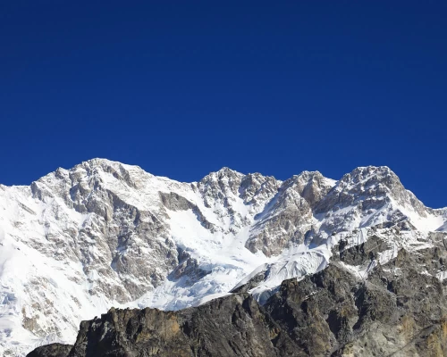
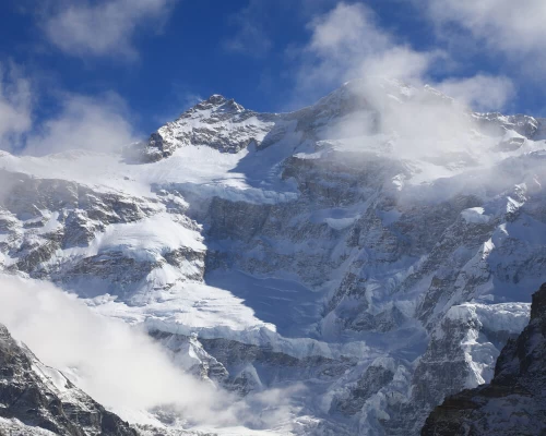
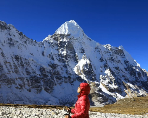
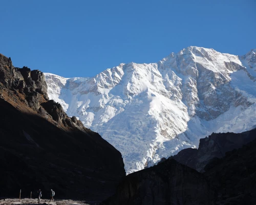
Festooned in ice and snow, the towering, massive Mt Kanchenjunga, along with other notable peaks in the Himalayan massif, is certainly a main attraction of the expedition. The Himalaya comes with five peaks and the Main, at an altitude of 8,586 metres from sea level, is the third highest mountain in the planet, after Mt Everest (8,848 m) and Mt K2 (8,611 m). 

For visitors, the Short Kanchenjunga Circuit Trek presents a walk in some solitude. Trekking in the remoteness of Kanchenjunga region makes this trip one of the best treks in Nepal many claims. The off-the-beaten trails remain proof that only a few trekkers walk the routes each year. Recent records show that the Annapurna region, the most favoured trekking destination in Nepal, receives +2,00,000 visitors annually whereas the figure for the Kanchenjunga region is only around 1000. 

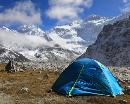
Besides fewer trekkers, what a Short Kanchenjunga Circuit Trek has on offer is pristine wilderness.  Around two-thirds of the landscape are snow and ice. Although the landscape sees human settlements at lower elevations, most of what remains are alive with wildlife.  

The villages en route certainly add to the experience. The relatively dense settlements at lower altitudes see a mix of people from many parts of Nepal. As the trek moves to higher reaches, however, the community populations first turn predominantly Limbus, an ethnic group known for their bravery. What attracts many is their traditional dresses, food and an alcoholic drink known as Tongba, which is served hot. The higher reaches of The land see Sherpa settlements. 

This Short Kanchenjunga Circuit Trek takes travellers to both the South and North Base Camps. The trail stretches about 230 kilometres from start to finish and requires 14 days of walk. The average is 5/6 hours of walk each day.

Trip Highlights

Amazing view of Mt. Kanchenjunga with its 5 treasure.

Breathe taking view of Kumbhakarna ( Mt. Jannu).

Cheram Village.

Kanchenjunga South Base Camp.

Kanchenjunga North Base Camp.

Sunset view from Khambachen.

Sherpa Settlements.

Local teahouse and Delicious Dalbhat with organic vegetables.

Limbu and Rai Culture.

Tea Gardens of Nepal.

 Ghunsa village.

Peaceful Trail.

Sele Le Pass.

Kanchenjunga valley.

Tibetan Culture and their lifestyle.

Buddhist Stupa on the trail.

Outline Itinerary

  • Day 01: : Kathmandu to Illam – around 10 hours' drive .
  • Day 02: Drive from Illam to Tapethok
  • Day 03: Tapethok to Tortang (2,995 m) – around 6 hours' walk
  • Day 04: Tortang to Tseram (3,750 m)
  • Day 05: Tseram to Ramche (4,350 m)
  • Day 06: Around Ramche ( Kanchenjunga South Base Camp)
  • Day 07: Ramche to Tseram (3,750 m)
  • Day 08: Tseram to Sele-La Phedi 3900m crossing Sele-La Pass (4,480 m) and Mirlang-La Pass
  • Day 09: Sele-La Phedi to Ghunsa (3,595 m)
  • Day 10: Ghunsa to Khambachen (4,040 m)
  • Day 11: : Khambachen to Lhonak
  • Day 12: Lhonak to Kanchenjunga North Base Camp(5140m) and back to Lhonak.
  • Day 13: Lhonak to Ghunsa via Khambachen.
  • Day 14: Ghunsa to Gyabla (2730m)
  • Day 15: Gyabla to Amjilosa (2,308 m)
  • Day 16: Amjilosa to Ranipul (1350m)
  • Day 17: Ranipul to Illam – around 6 hours' drive
  • Day 18: DRive from Illam to Kathmandu

Detail Itinerary

  • Day 01: : Kathmandu to Illam – around 10 hours' drive .
    We leave for Illam on an early morning. The drive starts out of Kathmandu on a hilly highway, enters the plains of Nepal and, once again, climbs up towards Illam on a meandering hilly highway. The vehicle stops for breakfast and lunch on the way. Illam is a hill station famous among the locals and is known for its tea gardens.
    • Illam
    • Breakfast, Lunch and Dinner
    • Guest House
    • 2230m
  • Day 02: Drive from Illam to Tapethok
    Our ride to Tapethok starts early. For many, this ride-on true hilly highways of Nepal comes as a fascinating experience. The vehicle stops for breakfast and lunch en route. We settle once reaching Tapethok, the trailhead, and prepare for the walk that starts the next day.
    • Tapethok
    • Breakfast, Lunch and Dinner
    • Guest House
    • 1250m
  • Day 03: Tapethok to Tortang (2,995 m) – around 6 hours' walk
    Through villages and farms, initially, the alternating ups and downs soon enter a forest. We stop for lunch on the way. Further up, amidst pines, spruces, firs, and hemlocks, Tortang is where we spend the night.
    • Tortong
    • Breakfast, Lunch and Dinner
    • Guest House
    • 2995m
  • Day 04: Tortang to Tseram (3,750 m)
    The trail out of Tortang towards Tseram starts out uphill to the steeper side. Passing through a dense forest, the trail gains altitude and walks all on the path past the snout of Yalung Glacier. As we approach Tseram, Kabru and Rathong mountains make their visible presence.
    • Tseram
    • Breakfast, Lunch and Dinner
    • Local Guest House
    • 3750m
  • Day 05: Tseram to Ramche (4,350 m)
    The walk this day is relatively a short one on this expedition. Once past the snout of Yalung Glacier, the ascending trail enters valleys, consequences of the evaporation of ancient glaciers. Meandering further, the path goes past clear streams as well as a frozen lake as the Himalayas – Kokthan, Rathong, and Kabru – come closer. Herds of blue sheep often catch the attention of many traversing. We stop for the night in Ramche, a result of an ablation.
    • Ramche
    • Breakfast, Lunch and Dinner
    • Local Guest House
    • 4350m
  • Day 06: Around Ramche ( Kanchenjunga South Base Camp)
    We start our walk early today. With packed lunch, we head towards Oktang, also known as Kanchenjunga South Base Camp. Although the actual Base Camp is about an hour further from here on, the place presents a fascinating view of the South Face of Mt Kanchenjunga. The ideal location for a mesmerizing view of the Himalayas is on the other side of Yalung Glacier. So, we cross the glacier and find our vantage points. The main attraction on offer is a long Himalayan ridge that soars above 7,000 meters with the summits of Mt Kanchenjunga rising high above the rest. Contemplation, reflection, inspiration are choices open to all. We return to Ramche for the night.
    • Ramche ( Kanchenjunga South Base Camp)
    • Breakfast, Lunch and Dinner
    • Local Guest House
    • 4700m
  • Day 07: Ramche to Tseram (3,750 m)
    Retracing our footsteps, we settle in Tseram for one more night.
    • Tseram
    • Breakfast, Lunch and Dinner
    • Local Guest House
    • 3750m
  • Day 08: Tseram to Sele-La Phedi 3900m crossing Sele-La Pass (4,480 m) and Mirlang-La Pass
    This is a long walk, the longest for the trek. We, therefore, start early. Crossing Sele-La and Mirlang-La Passes is certainly demanding but the rewards are worth it. The views from atop the Passes are memorable, travelers claim. The final descent ends the day's walk and we camp at Sele-La Phedi.
    • Sele-Le Phedi
    • Breakfast, Lunch and Dinner
    • Local Guest House
    • 4480m
  • Day 09: Sele-La Phedi to Ghunsa (3,595 m)
    Leaving the campsite, the trail goes through a forest and is a steep, rocky descent. The sharpness fades and presents comfort as the expedition nears Ghunsa.
    Ghunsa is a village where the ways of the people are governed by Buddhism. The fluttering prayer flags and Gompas (monasteries), therefore, welcome visitors. Their livestock sees yaks and sheep and they depend on maize and potatoes as their major crops. Ghunsa is also the highest permanent settlement in this valley.
    • Ghunsa Village
    • Breakfast, Lunch and Dinner
    • Local Guest House
    • 3595m
  • Day 10: Ghunsa to Khambachen (4,040 m)
    After breakfast, we start walking. On a comfortable uphill, the trail passes through a verdant forest populated by rhododendrons, pines, and cedars. We stop for lunch by a riverside. The incline now turns steep and remains so until the final downhill to Khambachen. Under the auspices of the revered Himalaya, Kumbhakarna (also called Jannu), we settle for the night in Khambachen.
    • Khambachen
    • Breakfast, Lunch and Dinner
    • Local Guest House
    • 4040m
  • Day 11: : Khambachen to Lhonak
    The trail climbs up past chortens above Khambachen. We soon find ourselves walking the northern side of Kanchenjunga Glacier. The trail reaches high plateaus and we walk past Lhonak Glacier. Lhonak is a sandy plain with a few huts scattered. We spend our night here.
    • Lhonak
    • Breskfast, Lunch and Dinner
    • Local Guest House
    • 4750m
  • Day 12: Lhonak to Kanchenjunga North Base Camp(5140m) and back to Lhonak.
    We walk for around three hours following a moraine and arrive at Pangpema (Kanchenjunga North Base Camp) at an altitude of 5,140 meters from sea level. Unmatched is the view of Kanchenjunga Main (8,586 m), the North Face of the Himalaya, along with others in the massif. With walks around for views from different angles, this day certainly is the climax of this expedition. We have our lunch and back to Lhonak to spend the night at Lhonak.
    • Lhonak
    • Breakfast, Lunch and Dinner
    • Local Guest House
    • 5140m
  • Day 13: Lhonak to Ghunsa via Khambachen.
    Retracing our footsteps, we stop at Khambachen for Lunch and Ghunsa for the night.
    • Ghunsa
    • Breakfast, Lunch and Dinner
    • Local Guset House
    • 3595m
  • Day 14: Ghunsa to Gyabla (2730m)
    The trail today does come with some ups and downs. However, we largely lose altitude and vegetation changes. Leaving the pines and junipers behind, we walk past Phole, a village en route. The path soon passes through a meadow and leads to Gyabla
    • Gyabla
    • Breakfast, Lunch and Dinner
    • Local Guest House
    • 2730m
  • Day 15: Gyabla to Amjilosa (2,308 m)
    The trail starts out a steep downhill but loses this sharpness soon. The trail continues further downhill, though, and passes through a dense forest dominated by rhododendrons and bamboos. We reach a river and the path climbs up for a while before the descent to Amjilosa. One more highlight of this part of the route is the many waterfalls.
    • Amjilosa
    • Breakfast, Lunch and Dinner
    • Local Guest House
    • 2308
  • Day 16: Amjilosa to Ranipul (1350m)
    This is our final day of the walk. The trail goes downhill out of Amjilosa. Through villages and farmlands, the walk finally ends once we reach Ranipul. Ranipul is a town and we settle for the night here.
    • Ranipul
    • Breakfast, Lunch and Dinner
    • Local Guest House
    • 1350m
  • Day 17: Ranipul to Illam – around 6 hours' drive
    Stopping for breakfast and lunch on the way, We reach Illam in about ... hours. We stop for the night here.
    • Illam
    • Breakfast, Lunch and Dinner
    • Guest House
    • 1830m
  • Day 18: DRive from Illam to Kathmandu
    We drive back to Kathmandu.
    • Kathmandu
    • Breakfast, Lunch and Dinner
    • 3 Star Hotel
    • 1400m